SUPARCO has implemented NatCat project for National Disaster Risk Management Fund


Pakistan’s Space and Upper Atmosphere Research Commission (SUPARCO) has released satellite images of flood-affected areas.
The image on the left, taken from the satellite, shows the scene before the floods, indicating that all the rivers are flowing within their respective limits.
The image on the right is after the floods, in which only water is visible.
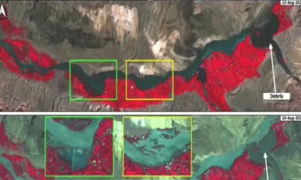
Another image is from August 22, in which the rivers are flowing normally, while the second image is from August 24, in which the rivers have overflowed their banks.
In addition, SUPARCO has implemented the National Catastrophe Modeling (NatCat) project for the National Disaster Risk Management Fund (NDRMF), which provides probabilistic risk assessment tools for floods, droughts, heat waves, storms, tsunamis, landslides, and earthquakes.

It’s no longer illegal to destroy the one thing endangered species need most to survive
- a day ago

A crucial governor’s primary just became Democrats’ biggest debacle
- a day ago

The right-wing boomers protesting data centers have a lot in common with the left
- 6 hours ago

Could you lose your right to vote if you bet on an election?
- 4 hours ago

The ticks are winning
- 4 hours ago

The big healthcare fight Democrats keep dodging
- a day ago

Iran is showing it can still fight back
- a day ago

Why Trump may be undermining his own Saudi nuclear deal
- 4 hours ago

The sci-fi movie that imagines AI isn’t so dystopian after all
- a day ago

Did Trump just kill his own nuclear deal?
- a day ago

How to be a good roomie — regardless of where you are in life
- a day ago

Whack-a-drone
- 6 hours ago